More stormy weather in store for Western Europe
There is only a brief respite before another spell of strong winds will hit the UK, France and the Low Countries.
Published On 2 Jan 2018
The New Year period is proving particularly stormy across parts of Western Europe.
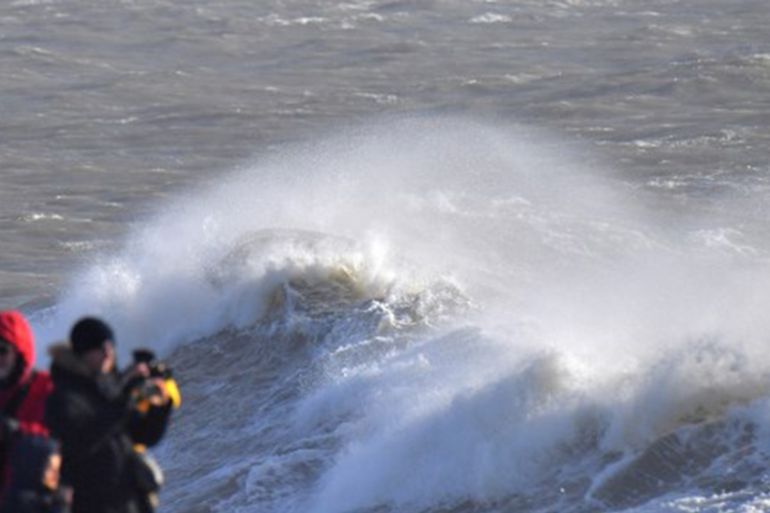
Storm Carmen hit western France on New Year’s Day with winds of 130 kilometres per hour (km/h). At least one person died, and more than 65,000 homes were temporarily left without electricity.
Keep reading
list of 4 itemsChina evacuates over 100,000 as heavy rain continues to lash south
Asia bears biggest climate-change brunt amid extreme weather: WMO
Photos: Highest-level rainstorm warning issued in south China’s Guangdong
Carmen deepened just to the south of the UK, meaning that the strong winds were reserved for the coasts of Brittany, Normandy and the Bay of Biscay.
Although Carmen has now weakened and moved on, there is another development taking place in the Atlantic that is expected to become a significant storm on Tuesday night and through Wednesday.
This next system has the potential to develop into a major storm, as it is expected to undergo “rapid cyclogenesis”, deepening by more than 24 millibars in 24 hours.
The storm, which is likely to be named Eleanor by the UK Met Office, could have a central pressure of just 966 millibars as it races across Northern Ireland and southern Scotland on Tuesday night.
Winds in coastal areas are expected to reach 110 to 130km/h, and coastal defences are likely to be tested as spring high tides coincide with the passage of the centre of the low-pressure system.
The bad weather from this system is unlikely to be confined to the UK. Instead, stormy weather will cross into the North Sea during Wednesday morning.
This will result in severe storms for northern France, the Low Countries, Denmark and Germany. Some coastal inundation is likely in several of these countries through the remainder of Wednesday.
Source: Al Jazeera, News Agencies